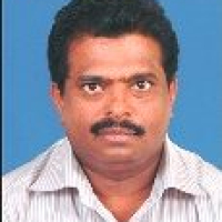
Dr. Venugopala Rao Koppaka
Advisor
Designation :
Advisor
Present Posting :
Administrative Staff College of India (ASCI) Hyderabad
Specialization :
Centre for Management Studies
Qualification :
- MPhil & PhD(Economics)
- Jawaharlal Nehru University , New Delhi
- Economics(Hons), SRCC Delhi University
Dr. Venugopala Rao Koppaka is advisor in the Centre for Management of Land Acquisition, Resettlement and Rehabilitation, ASCI. He is ex-Scientist/Engineer ‘G’ and Group Director, National Remote Sensing Centre (NRSC), ISRO, Govt. of India. He has graduated in civil Engineering with specialization of Advances survey & Photogrammetry from IIT, Kanpur and masters in Geology from College of Science, Master in Computer Science and Doctorate degree from College of Engineering, Andhra University. Dr. Rao has more than 30 years of experience in advanced digital photogrammetry, Remote Sensing, and GIS in large scale mapping; geospatial governance in the fields of urban, land survey & management, infrastructure planning & monitoring.
During his service in NRSC, ISRO, he lead initiatives to promote the use space based geospatial technology for effective planning & monitoring in major central government mission projects like PMAY-HFA (Urban), NHI, Railways, GAIL, Mines, MHA, aerial/satellite image based re-survey under NLRMP, NSO-Urban Frame work.
Among the notable projects successfully led by him include generation of 1:4,000 scale GIS database AMRUT cities, Geo-tagging of individual beneficiary houses under PMAY-HFA (Urban) for effective house construction monitoring; National Capital Region (NCR) Regional Plan Revision (RRP- 2021); large scale infrastructure (National High ways, pipeline network) planning and monitoring NHAI, GAIL; Tsunami Early Warning System, INCOIS:- Satellite based Digital Terrain Model development for entire Indian East & West Cost; Space based information Support for Decentralized planning (SIS-DP).
Established Remote Sensing & GIS Centre in Maldives and also provided Training to Maldivian officials for running the Centre.
He served various inter-ministerial committees and co-authored in the development of National Technical Guidelines (1) The National Land Records Modernization Programme (NLRMP), Ministry of Rural development (2) The Design and Standards for application of drone / UAV for large scale urban mapping, Ministry of Housing & Urban Development (3) Smart Cities Sectional Committee, CED 59, Bureau of Indian Standards (4) Geospatial Information Sectional Committee, LITD 22, Bureau of Indian Standards (5) AMRUT Design and Standards for GIS based Master Plan Formulation, Ministry of Urban Development (6) Urban and Regional Development Plans Formulation and Implementation (URDPFI) Guidelines, 2015 (7) Topographic Mapping from very High Resolution Satellite, SOI, DST.
He has published over 30 publications in National and international journals. He is a reviewer of Geocarto International, Journal of the Indian Society of Remote Sensing Springer. He is also reviewer of Ph.D. theses Andhra University, IISC Bangalore, IIT Bombay. He also served as Member of Board of Studies. JNTU Hyderabad, IIRS Dehradun. Guided / supervised 10 B.Tech and 70 M.Tech students and one Ph.D. student for Their academic project/thesis work. His area of interest are development & application of geospatial technology (Satellite, Aerial, Drone) in Urban / rural lands mapping & monitoring, geospatial governance in land acquisition, illegal / unauthorized constructions, land encroachments, large scale infrastructure (road, rail, oil & gas pipe lines) planning & monitoring and training & capacity building.
| Coming Soon |
© Copyrights reserved by Administrative Staff College of India (ASCI).
